
Land clearing cost per acre is not a set price. Acreage gives a starting point. Brush density, tree size, slope, water, access, and the finished use shape your quote. A property walkthrough before winter helps match the work to your land and goal.
For a broad look at South Mississippi land-clearing methods, start with our main guide. Here, we focus on what an estimator needs to see.
Why Acreage Alone Cannot Set Your Land Clearing Quote
Two ten-acre tracts can call for very different work. One may have scattered brush on firm, open ground. The other may have thick small trees and vines. It may also have soft spots and one narrow way in. The acre count is the same, but the machine path and finish are not.
A quote also changes with how much of the tract you want opened. You may own 40 acres but need only a building pad and drive cleared. The estimator needs the work area, not only the parcel size.
Start with what the land needs to become
Circle B3 starts its free walkthrough with a plain question: What does this land need to become? A building site, pasture, hunting tract, and right-of-way each need a different work area and finish.
That goal sets the clearing limits and finish. It also helps avoid clearing land that serves no part in your plan. Our land clearing service explains these property uses.
Did You Know? The parcel acreage and the clearing acreage may not match. Marking the exact work area helps the quote reflect the ground you want changed.
Vegetation changes the work inside each acre
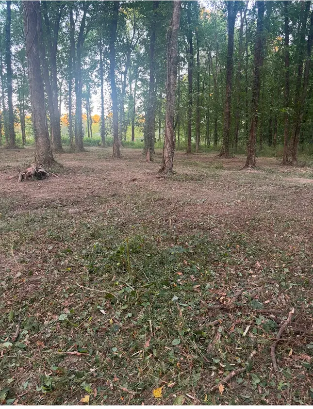
An open acre with light saplings is not the same as a packed acre. Brush, vines, and small trees add work. The estimator also looks at stem size, downed wood, and hidden debris.
The crew also needs to know what stays. Saving a tree, fence corner, food-plot edge, or timber screen calls for careful work. Marked keep and cut areas make the scope easier to follow.
Pro Tip: Use bright flagging to mark property lines, keep trees, corners, and the end of each planned corridor before the walkthrough. Tell the estimator what each color means.
What Property Conditions Shape the Scope
A useful quote is built from what the crew sees on the ground. This table shows how site facts can affect the plan. It does not set a fee or promise a result.
| Property condition | What the estimator checks | Why it matters to the scope |
|---|---|---|
| Brush and small trees | Density, stem size, vines, and downed material | Shows how much material must be ground and how many passes may be needed |
| Terrain | Slope, dips, banks, holes, and uneven ground | Helps set safe travel paths and clearing limits |
| Water | Creeks, drains, ponds, soft spots, and low areas | May change access, buffers, or the order of work |
| Entry | Gate width, road condition, turns, and overhead room | Shows how the skid steer can enter and reach the work area |
| Features to keep | Trees, fences, structures, utilities, and habitat cover | Sets careful work zones and no-go areas |
| Final use | Building site, pasture, hunting access, trail, or right-of-way | Defines what gets cleared and what finish the owner expects |
Slope and water need special care. Mississippi State University Extension says road planning may use aerial, property, topographic, and soil maps. Its forestry guide also ties road building and poor road care to erosion on forest land. These are general planning ideas. They are not a rule for every home lot. Read the Mississippi State University Extension BMP guidance.
Identify creeks and drains before setting the machine route. Buffer width and work limits can vary by site. Share any water feature during the walkthrough.
Did You Know? A gate can look wide enough from the road while a sharp turn, weak shoulder, low limb, or narrow bridge still limits equipment access.
How Wet Ground Can Affect Pre-Winter Planning
Rain does not affect every South Mississippi tract the same way. A raised, sandy route may firm up sooner than a low clay area. Shade, slope, and drainage all play a part. Soil and past traffic do too. No one should promise that winter work is always faster, cheaper, or drier.
Wet-ground access can change where the machine travels. It may also change which section comes first or call for a wait. MSU Extension advises keeping heavy equipment off saturated soils during forestry site work. Its soil guide says heavy equipment and traffic on wet soil can pack the ground. That can restrict space used by water and roots. See the MSU Extension soil compaction guide.
Access is more than the driveway
The estimator looks at the full route from the public road to the last work area. That route may include a gate or culvert. It may cross a field edge, old trail, creek, or tight turn. A firm entrance does not mean the back of the tract is ready for machine traffic.
The Mississippi Forestry Commission lists acreage, soil type, slope, water, access, and landowner goals as useful pre-work planning facts. Its forestry handbook also says roads are best built during drier periods when possible. These are broad forestry principles, not a date promise for your property. View the Mississippi forestry BMP handbook.
Pro Tip: After rain, take photos of ponding, ruts, flowing drains, and soft crossings. Those clues can help the estimator see trouble spots that may look dry on walkthrough day.
What to Bring to a Purpose-First Walkthrough
You do not need a full land plan before asking for a quote. Start with a clear goal: a building site, pasture, hunting-access corridor, trail, residential lot, or right-of-way.
Bring or show:
- the property boundary and the part you want cleared;
- the gate, road, or path the equipment may use;
- known utilities, septic areas, wells, fences, and structures;
- creeks, drains, ponds, low spots, and past wet areas;
- trees, cover, or landmarks that must stay; and
- your needed finish and any later work planned for the site.
Walk as much of the route as conditions allow. Mark any section you cannot reach on a map or photo. Show wet ground, past trouble spots, and old roads.
Circle B3 uses a skid steer with a drum mulcher. It grinds brush, small trees, and overgrowth into mulch on-site rather than piling or hauling it. The forestry mulching service page shows more about that process. The walkthrough confirms whether your growth, access, and finish fit that service.
A ready quote should name the work area, what stays, what gets cleared, and the finish you discussed. Ask how wet areas or access limits could affect the schedule. This keeps the quote tied to your property instead of a guess based on acreage alone.
Plan Your South Mississippi Clearing Before Winter
A land clearing cost per acre figure cannot show thick growth, a soft crossing, or a narrow gate. It also cannot show the finish you need. A purpose-first walkthrough can. Circle B3 will ask what the land needs to become. We will walk the work area, review access and wet spots, and scope clearing around your goal.
If you want to plan work before winter, start while there is time to inspect the tract. Request a free, no-obligation property walkthrough and estimate. Share your boundary, access route, keep areas, water features, and intended use. Your quote can then reflect the real South Mississippi property in front of us.
Frequently Asked Questions
How is land clearing cost per acre figured?
Acreage is one input, not the whole quote. The estimator also looks at vegetation, terrain, water, access, and areas that must stay. Your needed finish may differ for a building site, pasture, hunting route, trail, lot, or right-of-way.
Can Circle B3 quote my project from a map or acreage alone?
A map and acreage can help start the talk, but a free property walkthrough shows the conditions that a map may miss. It lets the crew see brush, slopes, soft ground, entry points, obstacles, and the exact area you want changed.
Does winter make land clearing cheaper or faster?
Winter does not guarantee a lower price, shorter job, or firmer ground. The scope and schedule still depend on the site, current conditions, access, growth, and finish. Ask about timing during the walkthrough rather than relying on a seasonal rule.
What should I mark before the estimate?
Mark clear property lines, the work boundary, keep trees, utilities, fences, and corridor ends when you can. Point out creeks, drains, and low spots too. Show routes that have stayed soft after rain so they can be discussed before the scope is set.